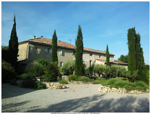
On thursday May 31st I left with the Cellule de Loisir of the Blancs Gilets cycling club to Crillon-le-Brave near Bedoin. After a relatively easy and traffic-free 950K we arrived in Carpentras.
Settling in in the La Condamine , we decided to go out for a ride, a little 'mise en jambes' to let our legs recover from the 10-hour car ride.
Thursday May 31st:
We left our chambre d'hotes and after a couple of K arrived in Bedoin. We rode on in the direction of Malaucene. Climbing up to the top of the Col de la Madeleine. I enjoyed to smooth ride the Vortex with its tubular wheels offered. Compared to the others the wheels also allowed a faster freewheeling speed, du to the Cult Ceramic bearings.
The asphalte was smooth and the 6-7 percentage of the Col didn't offer too much resistance. One half hour into the ride, we turned around and rode back through Bedoin. Later that evening we returned by car for a good dinner in one of the restaurants.
Endomondo track
Ride Stats : 23K and 305 heightmeters (Garmin) in 54mins
Friday June 1st : The Mont Ventoux.
After a good night's sleep I was ready for the big ascent. We would climb the Mont Ventoux from Bedoin. This meant an average slope of 7.5% over 21.5K. Not something to be scoffed at.
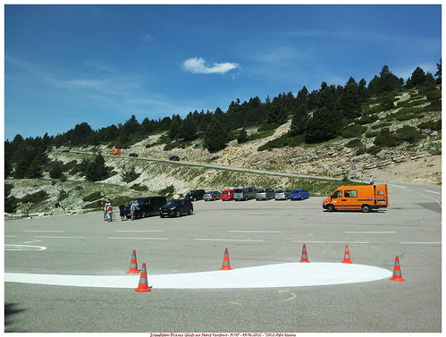
The temperature was already rising to 25 degrees when we rode out at 10AM. First descending into Bedoin and then taking the D974 out . After 2K we follow the D974 to the left where it splits off from the D19. Up to the Saint Esteve corner the slope is easy with around 4-5 %. At the Saint-Esteve the real Mont Ventoux climb begins. The slope goes to 9-10% and will be averaging that for the next 9.5K through the forest. I quickly settled on a pace and the chain went to the 34/27 combination. The forest was hellish. Hot with temperatures now flirting with 30 degrees C and the steep road, the steep road. Spots were the road reaches 12 and 13 % are common. The inside of the curves goes up to 17%.
Kilometers looked that they never would end. The mental game was starting. "I won't make it, lets try for Chalet Reynard and then turn back". But as the kilometers went on I got more confident. Keeping a pace comes easy to me, and around one hour into the climb I reached the Chalet. Here I could stock on water and have a first look at the rest of the climb. The dreaded moon-like wilderness of white stone and an asphalte ribbon making its way up to the naked crest of the mountain.

CC
The climb eased out just a little for the first 2K out of the Chalet. But another adversary was rearing its head. The wind which blew from the right over the crest. Each time the road veered into it, it felt as if a giant hand was slapping in your face. Once I was 'en danseuse' , standing upright on the bike, and was nearly topped over by a sudden gust. I decided very quickly to remain seated for the next of the climb. Pausing at the Tom Simpson memorial plaque around one K from the top brought a little relieve. But the last K must be the toughest of them all. Nearing a 9.5% average and with the wind blowing full force over the Col des Tempetes. But all things come to an end and with a big sigh of relieve and really proud of my achievement I reached the top. 1912 meters after a 1600m ascent.
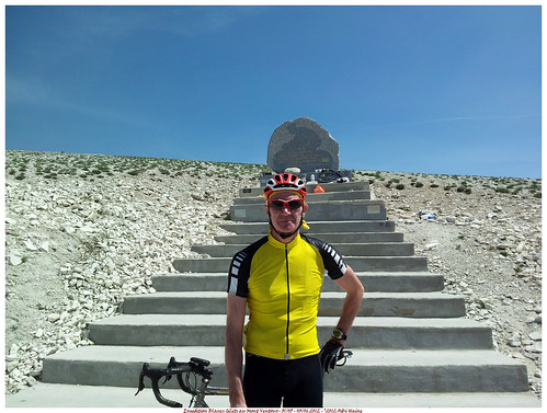

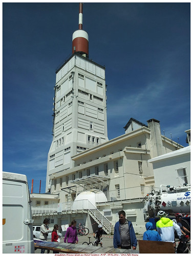
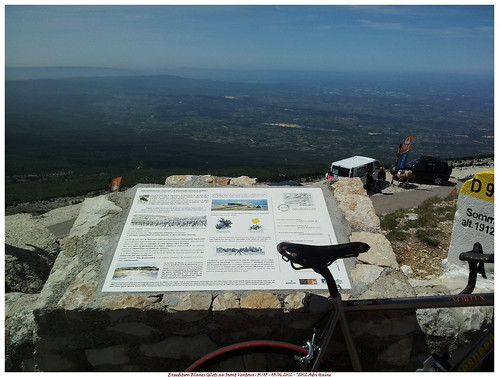
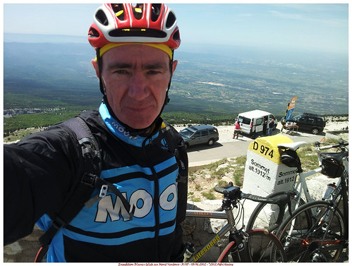
The view from the to is simply amazing. A 1600 meter vertical drop into the valley below where I can spot Bedoin and literally see for miles. On the other side the white caps of the Alps, some 100K to the east, are easily spotted. The wind forces me into a jacket and the temperature up here is an easy 23 degrees, some 10 degrees colder than the valley.
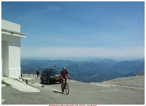
After some time we decide to move on and drop down into Malaucene, some 23K further down the mountain. After 33 minutes and with an average speed of 47 kph we arrive at Malaucene and settle down for a good meal. We have certainly earned it.
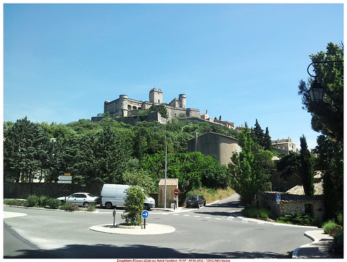
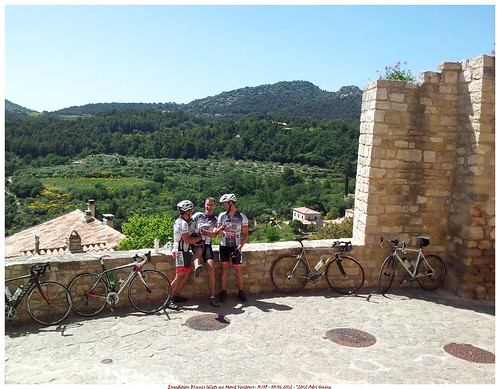
We continue our ride with a loop towards Suzette and Le Barroux. We spot the Dentelles de Montmirail as we go over the Col de La Chaine. We stop at the chateau de Le Barroux for a little pause.
Riding on towards Caromb and Modene we made it back into Crillon-le-Brave. It was a memorable ride and I thoroughly enjoyed it, in hindsight.
The evening saw us taking the car into Avignon for a dinner at the "Filles au Piano" dans the Rue Galante.
Endomondo track
Ride Stats : 72K and 2300 heightmeters (Garmin) in 04h05mins
Saturday June 2nd: Les Gorges de la Nesque
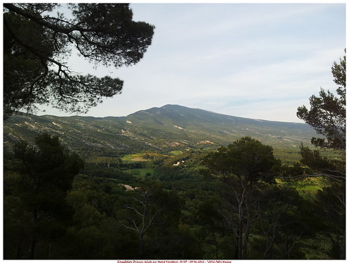
The legs felt a little less 'estival' today so we quickly decide to take it easy in the first couple of kilometers . Making our way along Flassan towards Auzo where we started the ascent towards the Gorges de la Nesque. The road here has a very steady climb in it that takes you for 18K along one of the highlights in this area, the 300 meters deep Gorges de la Nesque. The sun was out and even though the legs didn't feel very willing to ride I thoroughly enjoyed the beautiful landscape. Stopping at the culminating point to take a picture, I could see the Mont Ventoux looming in the background. Omnipresent it is.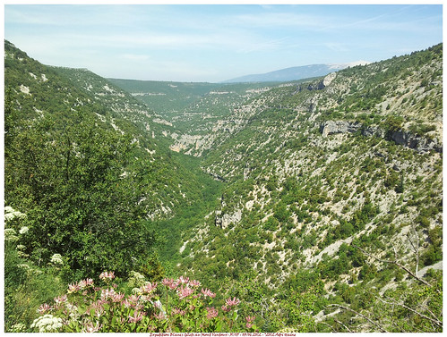
We rode on until we came to Monieux. Here one of my friends knew a great restaurant so we took a long break whilst enjoying a fine meal in restaurant Les Lavandes 
After the meal we crossed the Nesque and started the slow steady climb towards Javon along the N90. On the top we had another great view accross the Gorges towards the Mont Ventoux.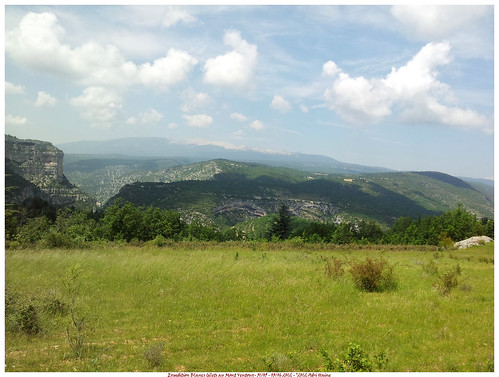
Moving on and now a very long downhill awaited us, bringing us from a height of 830m into Methamis where we rode on into the valley towards Mormoiron situated at 203m above sea level. From here it was a breeze in the sun and with only a light wind to make our way back towards the Gite at Crillon-le-Brave. A very fine ride with a great lunch at Momieux.
Endomondo track
Ride Stats : 81.5K and 1700 heightmeters (Garmin) in 3h37mins
4062/45315

No comments:
Post a Comment