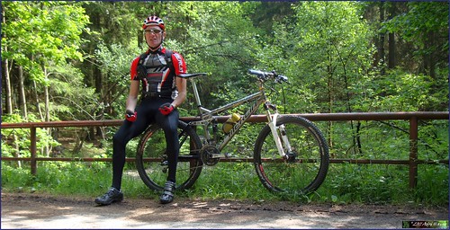
A perfect day for a long ride in the Ardennes. So I took the Merlin to Theux and the Chateau de Franchimont to have a go at my longest descent.
Arriving in Theux and parking before the Chateau I started out taking the steep downhill into Theux and then the "longest uphill" could start. The weather was promising, with an open sky and a temperature of around 15 degrees C already at 10am. It would remain sunny throughout the ride with tempetures around 20 degrees C.
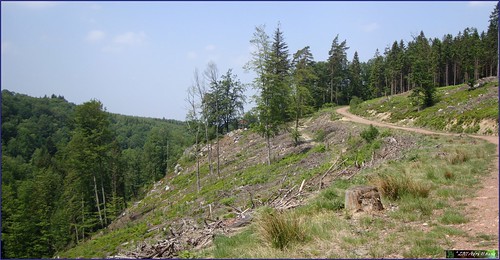
The first part of this ride consists of climbing towards the highest point of Belgium, the Signal de Botrange. Over the years I have worked out a route that incorporates a lot of offroad stretches without becoming too difficult. On my way up to the Golf de Spa I encountered some bikers that were laying out chalklines. They told me that tomorrow there was a Randonnee at Tiege. That is certainly a good way to discover this region. I would encounter their markings a lot during the ascent and the descent back to Theux.
After a little more than 2 hours of biking I arrived at the Signal. The tracks had been dry and even on the fagnes one could note the effects of the long period of dry weather our country had been suffering during these last couple of months.


I had a snack overlooking the Fagnes towards Germany but moved on when a big group of tourists arrived. All they were interested in was where the fire had been.
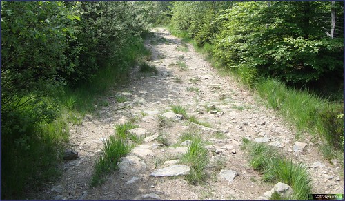
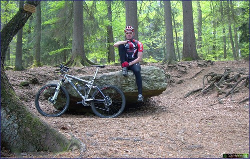
Starting the downhill then. This is the most difficult part of this ride. First I had to follow a very beautiful track taking me to the Vecquee. I would consequently follow this ancient trail towards the Hoegne. Here I also noticed how dry everything was. Usually there are always some 'boggy' sections, where you had to move into the forest next of the trail to circumvene mud and water. But now everything had dried up offering good traction and a steady path. The last section was a very rocky descent but the Merlin took me through that without any problems. This might not be the best region to ride a hardtail.
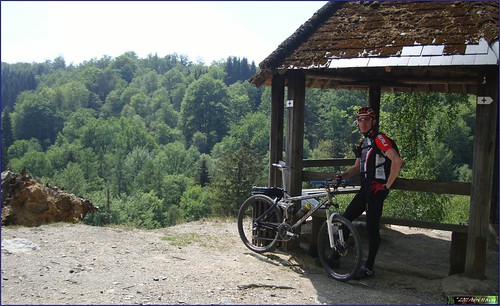
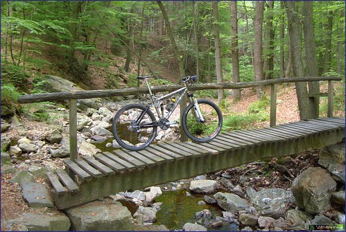
From the Passerelle du Centenaire at the edge of the river Hoegne I followed a path that took me to a little belvedere, a pavillion overlooking the deep valley of the Hoegne
The ensuing downhill along this track was a great one. Crossing little rivulets from time to time and over rocks and stones at other occasions. I arrived at Belleheid where I would change the track on my GPS. I had decided to make a detour to have a look at the Dolmen of Solwaster and the Rochers de Bilisse. I had been there before but this was over 20 years ago. I made a track on Mapsource taking me there and back again. This was a track I now activated on my Garmin Edge 705.
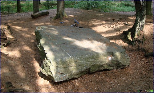
It started by following the GR573 that would bring me to these artefacts. The climb back up the ridge was steep and hurt my legs after the long downhill sections from the Signal. But since it was a GR riding a bike here was challenging. Arriving at the Dolmen and later at the Bilisse rocks, I took some time to take pictures and then started to follow a walking track next to the River Statte.

On the map this had looked fine but it was impossible to ride my bike here for more than a couple of meters at a time. Even walking proved very difficult. Beautiful wild landscape indeed. Rocks and steps, bridges and roots. Oh well, I moved on and at last reached a road where I could get on my bike again. For those who decide to follow the GPS track, I would advise following the GR and climb up the twisty track behind the Rochers de Bilisse. This will save you some 20 minutes of walking .
Riding down towards Solwaster again was great, some really beautiful tracks and a long sweeping downhill to reach the river Hoegne . Following this river I am now back on my usual Theux - Signal de Botrange - Theux track. Arriving at Polleur this means getting back up the slope to arrive in Sassor. I could not resist turning to the right before reaching the road to the Chateau de Franchimont. This meant another uphill but also took me to the steep downhill along the GR route into Theux. But I rode it completely, including the steps at the end dropping me to face the Insitut Saint Roch. Riding back towards the chateau I took the long version of the climb this time instead of the short steep one I took when descending at the start of this ride .
Ride Stats : 70.5K and 1275/1315 heightmeters (Polar/Garmin) in 4h18mins
3358/35765

1 comment:
Hi, I came across your site and wasn’t able to get an email address to contact you. Would you please consider adding a link to my website on your page. Please email me back and we'll talk about it.
Thanks!
Mandie Hayes
mandie.hayes10@gmail.com
Post a Comment