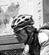
When I got out of bed this morning I still felt a bit tired from yesterdays' ride. I didn't have high hopes for my condition today but I had promised to be at the start in Haasrode at 7am so I rode out anyway. After a couple of hellos I rode off with another biker who would accompany me during the first kilometers until the 52 and 62K distance split. Meerdael forest was glistening with dew and the bikes were wet from riding through the grass on our way to the forest. It was warm with 19 degrees C but the forecast called for possible rain later in the day, even thunderstorms in the late afternoon. So the early biker got the worm today. After this intermezzo I rode on and when I arrived at Nethen I noticed an arrow had been removed at a crucial spot. A left turn . I replaced the arrow so that the bikers would not take the Bruyere de Wez going straight up - an 18% tarmac climb - but instead turned left for a steep offroad climb ending with a small step. A bit more of a challenge for a mountainbiker. I crossed someone from Mountainbike Tour Trips at the top of the climb. He was possibly also confused about the missing arrow. A bit further I descended back towards Nethen and stood at the start of the infamous Lianenklim. There is also an easier track, not through the deep and wet gully but following tarmac, cobbles and a track though the fields instead. I took the easy option. I wasn't sure about the condition of the track in the Lianenklim and I didn't want to be stabbed to death by gnats or even horseflies. I continued towards and through Bossut and after 20K into the ride I arrived at the first rest stop high up in Gottechain. There still were no bikers here, only members of the organisation. I told them of the missing arrow and advised they sent someone over to re-check. I then rode on, taking a very steep downhill that might make some victims among the 52 and 62K bikers that pass here. The 42K and other distances split off just after the rest stop so now I was on long-distances-only trails. Into and out of Grez and then crawling up the steep cobble climb to Biez. This is the start of a very intense section in Brabant Walloon, where a lot of heighmeters, some marvelous views and sheer fun are to be had for the mountainbiker. When I arrived at the first rest stop, I already had around 350 heightmeters, but the next section of 15K would easily double that amount. I was still riding alone and was enjoying the first rays of sunshine . The sections in the Forest de Glabais are some of the finest in the area. At times one could imagine being in the Ardennes. But I also know that this is amongst the last really tough climbs. I am nearing the 2nd rest stop at the edge of the Bois de Linsmeau and here I encounter the first real muddy puddles. But those who are 'in the know' can take a little singletrack that runs parallel to the muddy track. I take a break at the rest stop and have a little chat with the volunteers manning the stop. Thanks has to go to each and every one of them. They also sacrifice their free time to help us organise this ride.
When my bike companion for half an hour took a left at the 52/62K split I was riding alone through an awakening forest. My job was to control the signage , if needed replace broken or stolen signs and make sure the riders, who could officially start at 7.30am, would not get lost . When the trail is ridden in this direction - counterclockwise on the map - the toughest bit of the ride comes first. A loop with some solid climbs and tricky descents on the Nethen side of the Meerdael forest. The sand in the Savenel area was deep and stuck to my wet bike. The long climb up to the plateau again was immediately followed by a fast descent towards the Kluis. It made my glasses foggy with the contrasting warmth of my body against the crisp forest air. The loop through the Bois de Beaumont led me down the long hollow road towards Nethen. When I was near the end, I saw a rope that had been spanned over the road. There was a festival of some sorts in the fields surrounding the track and the two fields had been connected by ropes. I stopped and had a talk with one of the festival people. I explained him that there was a mountainbike event passing here and that it would be better to remove the ropes. So we did just that.
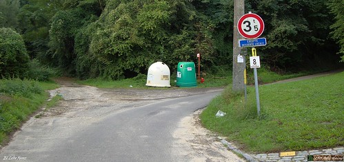
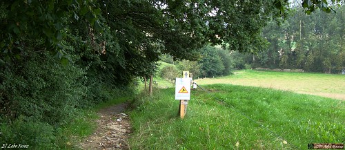
The sun was frequently obscured by clouds but it remained dry. The small grassy track leading down into Pietrebais demanded my full attention. Even though the grass had been mown a couple of days ago, there were still dangers hiding below the greenage. Hidden ruts and even stones can easily topple the unaware biker over. A long climb on tarmac takes me back out of Pietrebais and then downhill again through a forest on a dangerously washed-out track. I drop into Cocrou. Here care has to be taken, the small road to the right is easily overseen. But the signage is OK and only the fast and the furious will miss the turn. For them, we have put some extra signs further down into Cocrou village that will lead them back to the trail, eventually. The long climb through a beautiful hollow forest road from the Fond du Moulin up to the plateau through the Bois de Beausart stresses my legs.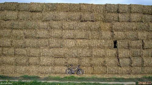
The following downhill is a bit less dangerous than yesterday because the tree that had fallen over the trail has been removed. I also notice that the sandy bit is a little deeper than yesterday. I see my first bikers on the trails when I join the 42K riders coming from the left. From now on I can up my tempo a little bit and play catch-me-if-you-can with the other bikers. Some can catch and pass me , others try but die in my wheel. Life is fun.
The ride now mellows out a bit going though the fields between Gottechain and Tourinnes le Grosse. We cross the language border near Valduc and disappear into Meerdael Forest once again. A loop that takes us from the Walendreef and the Weertse Dreef to Mollendaal, the highest point of the forest, and then down into Bierbeek. A last climb following the De Betstraat hurts because it is long, grassy and difficult. Then I am back at the Haasrode Sports Complex where I started 65K , 3h48mins and over 900 heightmeters earlier. Riding back home I take a couple of backroads and small trails just for the fun of it. I had a good ride today.
Ride Stats : 73K and 930/1020 heightmeters (Polar/Garmin) in 3h56mins
Stats TT Haasrode : 65K and 935 heightmeters (Garmin)
Track on EveryTrail :
TT Haasrode Natuurvrienden 65K at EveryTrail
Plan your trips with EveryTrail iPhone Travel Guides
6393/68335
Sunday, August 22, 2010
Natuurvrienden TT Haasrode
Subscribe to:
Comments (Atom)