Saturday, September 22, 2007

Longest uphill

Fine weather this morning so I decided to ride to Theux and take a shot at the Longest Uphill, linking Theux with the Signal de Botrange which , at 692 metres of altitude, is Belgiums' highest point. I started out at the Chateau de Franchimont, as usual, but decided to follow the Green Adeps Loop first, which took me towards Polleur and then up into the majestic Bois de Staneu. A quick downhill took me to the other side of that forest and there I caught up with the trail leading towards de Golf de Spa and my regular route towards the Signal. I was with the Moots and was a bit curious how the Nokian NBX Lite tyres would perform in the Ardennes, which are of course rocky, wet and with steep climbs and descents. Had no worries whatsoever with my tyres except a flat caused by a thorn just before I reached the Signal de Botrange. I only had to grab the map 2 or 3 times to make sure I was taking the right road (usually when I was on tarmac - I tend to remember the offroad bits quite well) and the extra starter loop made for a longer uphill, and almost a 1000 heightmeters before I reached the Signal de Botrange. The trails were astonishingly dry. When I arrived at the Vecquee, I tried a new path, which took me down again over a very technical and rocky descent - glad they were dry ! - and then back up towards the bridge over the Hoegne. All this to avoid a privately owned area in the middle of the Hautes Fagnes National Park!

I encountered a group of some twenty teenagers who looked lost and asked me how to get to Hockai. I pointed them into the right direction, adding to their horror that it would take them at least 10k before they would get there. Yeah, I am a mean bastard, but that will teach them walking into the Fagnes without a map. It couldn't have been more than 4 or 5K, so they will be happy in the end.

I still had some K's to go myself so I got back on my bike and ascended towards the Signal, the tracks remaining dry and smooth-rolling. Near the end I felt my rear tyre losing air but I made it to the viewpoint overlooking the Fagnes towards neighbouring Germany. There were a lot of tourists around and I was joined by a Forester who was also a keen mountainbiker, so we had something to talk about while he watched me change my inner tyre. He uses kevlar patches to protect his inner tyres but I'm thinking that I will go towards NoTubes. I already have specced NoTubes on my newest bike - the yet-to-be-built Merlin Works 4.0. I complained to the Forester about the lack of waste bins along the routes in the Fagnes but he countered that the wildlife destroys them when they smell the food thats been left in them. Good point I reckon.
The descent then. I tried a new track, taking me towards the Croix des Fiances and the Vecquee again. A small track with some very interesting technical challenges. I'm not sure if bikes are allowed though, but I did not see any sign indicating they were not. At one point I had to cross a little stream by foot before having to ride over some plank-bridges that spanned some very wet patches of moor.
Along the Vecquee then back towards Hockai and the Hoegne. The Hoegne river is the red thread that leads throughout the descent, which obviously is one of the longest to be experienced in Belgium. The bike was getting wet from time to time because the track crossed the Hoegne, either via a concrete ford or just plain through the little river itself. There is no way you can do a ride in the Ardennes without getting your bike wet, even in the midst of Summer. The bike performed well and by now I began to feel the kilometers stacking up. Even during the downhill there are still a few uphills bits, not far but they hurt. When I arrived in Polleur again I went back up the hill for a nice little finale adding another 110 heightmeters to my Polar counter.

Ride Stats : 71K and 1120 heightmeters in 4h19mins

Tuesday, August 14, 2007

Raid des Sources


Rise and shine at 7am. The sun was out and half an hour later I was on my way to Chimay. This is a 1h30 car ride from Leuven. When I neared Couvin the hills were covered in mist. Still, no worries, I was about to embark on a marathon mountainbike raid over 100k so I was not exactly screaming for heat. Only dry weather would suffice because the extra warmth only adds to the exhaustion..


The Ride:

Around 9.30 I was at the inscription where I forked over 12€ and got my number and a little card attached to a lanyard. This card was to be used for punching in the control markers at the feed zones along the ride. There were 5 feed zones evenly spaced out on this distance. Great, so let's go!
I had a possible riding time of 6 hours in mind when I started out, but things would evolve. Read on.
The first kilometers were relatively easy, the track was reasonably dry - small wonder after last thursdays' downpour, so I could settle myself into a nice and comfy pace. We were going through some fields and the sun had dried out the trails here . After a while, I was remeniscing my last outing here some 5 years ago , when all of a sudden the first uphill appeared. Steep and wet in an overgrown hollow road and I was too late to drop my chain on the small ring. So I had to grin and bear it. I made that hill but I would not forget to drop my chain the next time. At the top of the second big climb there was a photographer – I think it was Denis Hardy, the organiser - taking some pictures.
I quickly shifted onto the middle ring - looks better on the pics - and tried to look calm and collected.
After crossing the N99 , road that connects Couvin to Chimay, the “real” Raid des Sources was about to begin. We were entering the forests now and the height lines started oscillating between 200 and 350 meters. Things were getting serious quite quickly !
After 13.5k we had a first feed zone and after 25k the second. This was also the place were the 100k split off from the 65k distance. We were at the rivers’ edge here, so instinctively I knew a big climb was following . From here on I would ride relatively alone. Having started late and with most chrono riders going for the 65K distance, this is one of the great advantages of doing the longest distance. The extra loop started with a 27% climb on tarmac (thank God!) out of a village and slowly but surely I creeped into the forests again . At one point I was riding next to a big lake – barrage du Ry de Rome - at 270 metres of altitude. After that, a small trail took me up to the plateau at 330 metres through some damp forest which reminded me of the Vosges. At the plateau the track was following a singletrail for several kilometers on end , green and lush landscapes galore.
I had to look constantly for the best passage, since we were crossing mud-holes and little tricklets all the time. There was a fair amount of water and mud here, but due to only 75 people riding the 100K, the trail was not beaten to a pulp and fairly easy ride-able.


Far from easy were the descents, some rather rechnical with wet rocks and roots thus demanding the utmost concentration not to let the speed get up too high. I managed them all very well but I screamed a few times because I thought I lost it. Luckily my bike got me through . The uphills were typical of the Chimay region, steep - usually around 20% - and due to the wet floor pretty difficult to ride. My wheel was slipping all over the place with the sticky mud filling up the gaps between the knobs on the tyres and sometimes I just made the hill, sometimes I didn't and had to walk a few meters. About halfway through this 40k loop we encountered our 3rd feed zone and control point.
I was passed at one point by the eventual winner - Wouter Cleppe - and I was amazed at his speed and seemingly ease with which he was tackling a mean uphill. He rode the 100K in 4h29mins, which is quite amazing.
After an amazingly beautiful – but very tough – loop we were back at the barrage where we had about 1.5K of tarmac to relax our muscles a bit. After that, an impossible climb had me walking up a crest and I was back in the rough following some forest trail again meandering through the trees.
With some 65k I was at the 4th feedzone (which was actually the 2nd - I had now completed my extra 40k loop) and I took my time eating and drinking. At this point the mental thing comes in. You realize that you would already have finished had you not chosen the longest distance. With still an average TT distance to go you have to keep your mind firmly on the right track. Furthermore the fatigue was making itself feel and the tracks were now worse due to the many riders having ridden over them. After that 4th feedzone there was a long climb taking us all the way up again. It was very steep at places and along the way I was passed by an enduro motorcycle of the organisation. I had seen him at the rest stop and he replied to my gentle wave with a ‘Bonne Chance’ while he poured on the horsepower and rocketed upwards.. Yeah, I would need some good luck for sure! I was thinking how nice it would be if we could swap our bikes for a while but quickly let go of that tought when a mean downhill was announcing itself.
The relentless succesion of climbs and technical descents were effectively sapping the strenght out of my legs. I saw some riders standing next to the road, they were waiting for the organisation to pick them up – wasted and dead- tired and probably having seriously underestimated the difficulty of 100K in this area.
Around 81K into the ride I came to the last feed zone. I had teamed up with a team-mate of Wouter Cleppe and we more or less rode together for a few kilometers. The track wasn’t wide enough to ride next to each other but we managed to talk a bit along the way. The trail was now very muddy. Tough conditions due to the fact that all the distances had passed over this trail, effectively munching it into a brown splashy pulp. A few sections were really really bad, and I had to jump around from dry side to dry side to keep my feet out of the muck - the gullies were too deep to ride . Luckily we were sent onto some bigger forest tracks as well, so we could recuperate a bit between muddy patches.. This nearly was ‘Trop is teveel’ – too much of a good thing. Some 10K before the finish we came back onto field roads and the trails were dry now. I was feeling elated and actually found some hidden strength and started accelerating , enjoying the small tracks between the barbed wires. The last couple of K’s were on tarmac, having me zoom along at 30kph. After 6h36 of riding time and 6h57 actual time I was clocked off at the finish. Taking some pictures along the way and splashing out at the feed zones takes some time of course.


Got a nice finisher T-shirt and a one-litre bottle of Chimay. Rinsed my bike and got a shower before heading home again. It was 6.30pm when I arrived – tired but satisfied after a very long day.

The Lowdown:

What I liked :


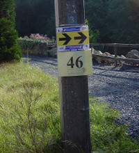
- Arrowing was flawless, both red paint markings on the floor/tarmac as arrows yellow/black panels.


- Plenty of feed zones , evenly spaced along the distance.


- Feed zones were well stocked with food and drink and friendly people.


- Great trails !


- Bike-wash was sufficient at 4.30pm.


- Shower facilities first-class.


- Danger signs at the really tricky descents and at the road crossings.


- Nice to get a t-shirt and a one-litre bottle of Chimay beer.


What I did not like:

- Bike-wash might have been busy before 4.30pm with only 3 jets.


- Damn mud !


- Dangerous passage in Chimay village at the end of the ride.


Synopsis:

Clearly a very professional and well-honed organiser and team, with the 15th edition this year they clearly know their fantastic – but unfortunately slightly underestimated - region and make the best of it, lacing together a 100k trail is no mean feat. Trails are tough and singularly beautiful , a combination most mountainbikers will appreciate. Succession of sometimes very steep climbs and sometimes rather technical descents and kilometers of singletrack , 80% through forest – must be mountainbiker heaven. I did ask the organisers to consider moving their ride back to the 15th of August though, as it has been for all these years. That date has become a landmark in the calender so why change it?


The area of Chimay – Viroinval – Eau Blanche and Eau Noire - is a bit underestimated I feel and not well known to the mountainbikers in Belgium. The valleys are not as deep as in some parts of the Ardennes but the region is well compared to Houffalize . It offers a lot of trails – I saw several marked routes along the way – and as I already said, the hills are steep - to be compared with La Roche perhaps - and offer between 100 to 150 meters of vertical ascent in one go. But what really makes this area shine is the amount of singletrails – credit has to go to Denis Hardy and his team for lacing them all together – some next to the rivers , meandering up and down with lots of roots and rocks making them very technical at times. I particularly remember a trail near Bruly-sur-Pesche where I had to walk quite a few times due to the technicality of the track. Of course the rain had made it a lot wetter than it usually is. The only drawback this region has is that is not along any of the major highways in Belgium, which means that getting there by car is not evident.


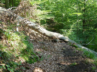
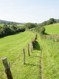
Some pictures..


The Bare Facts : Ride Stats : 100K and 1650 heightmeters in 6h36mins Hill Factor : 16.5 Mud factor : high
Organisers' Website : CLICK
Ride Profile : CLICK


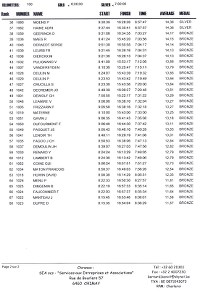
Results Marathon 100k :


Video Footage from the ride: CLICK (copyright Cédric)

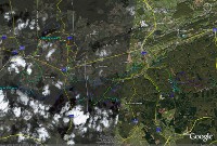
Google Earth Map of the 100k marathon :


7152/66420

Saturday, August 4, 2007

Ride The Red

It was 7.46 am when I turned my car onto route 666 leading towards Banneux and its Catholic Pilgrimage . It struck me that 666 was the last number I would expect in an area like this but I guess someone at the Roads' Department must have had a weird sense of humour. Took me some time to find a suitable parking spot not far from the N62 where I could get on the Red Theux route. This route - which I already did before - has the reputation of being one of the toughest in Belgium. I wanted to start real early to beat the heat. The sun was already making it's way up and the morning dew was evaporating quickly when her rays touched the wet grass. I started in Banneux because I wanted to have the toughest bit of the Red route in the beginning of my loop. The great singletrack descent towards the Forges Thiry was sadly not completely ride-able. At least at 4 spots some big tree had fallen over the trail, which meant descending from the bike and getting started again afterwards.

At the bottom of the descent I spotted the signage for next Sunday's UCI Marathon World Championships , which are held at Verviers. They are descending the Forges through an alternative path I believe.

After crossing the busy N690 I could start on one of the many steep and tricky climbs the Red Theux is famous for. The Championship track follows the Red trail for a while until they enter some private property and I had to take a right turn. After a while of going up and down, mostly through forests but also some little stretches of tarmac and lastly descending into Theux itself I was on the very steep climb which follows the Rue de Chawieumont out of Theux and up to the road leading towards the Franchimont castle. This is where the route I was on officially starts. At one point I had to walk because I was not prepared to push that hard in the beginning of the ride. When the steepest - middle - bit was over I got on my bike again. There was a family - Man, Woman, Child - taking a rest at the top of that climb and they knew exactly what I meant when I passed my hand across my throat. We shared a laugh and I was back on my way.
This is a real killer climb, especially since it is near the end of the route and it wrings the last ounces of power out of your legs. But smart as I am, I had this one near the beginning - relatively speaking since I was some 20K into my ride.
When riding towards Sassor I spotted a few bikers before me who were also doing the Red. They just left and were relatively fresh. I missed a turn near Au Fays - I always seem to miss this one - so when I got to the E42 I was in front of them. I stopped for a little snack and they passed me going down into the Thier de Polleur, a very nasty descent. In the next uphill, leading into the lower regions of the Bois de Staneu I passed them. They seemed to be already tired or were maintaining a slow pace. They confirmed me they were doing the Red route and I wondered if they would make it judging by the speed they were going it would take them a while to say the least. But then, each has his or her own pace. Mine was faster than theirs so I continued dropping out of the Staneu Forest onto the road from Polleur to Theux.
After a while I disappeared into the forest again for a steep climb towards the route du Pré des Lis. Down towards the railway track and then a little tarmac passage leading over the busy Spa road and to another rocky ascent parallel to the route de Becco . This was the first ascent which had me shift onto the small ring in front. It would not be the last. The trail then climbs more or less all the way through Hestromont, with a lovely little track leading into a green valley. But beware - the track is rock-strewn and partly overgrown with grass so it is quite dangerous if you misjudge your speed here !

Up towards the "Maquisard Inconnu" monument it now goes, via a large gravel road which leads through le Gros Thier , a nice forest. The height is creeping towards the 350 metres mark as I stop for a little break near the monument. When I leave I notice a strange sound coming from my front wheel and lo and behold, a big thorn has found its way into my tyre. Another break coming up !
I took my time fixing the tyre - must let that adhesive vulcanize - and after a while I could continue towards Banoyard , the 400 metre mark ánd the top of the Ninglinspo valley, a valley which I refer to as Dreamland . I remembered exactly which track to take from the last time I was here . Some 100 metres down I enjoyed the view from the Point de Vue Drouet, this time in full summer and the greens were even more lush. Deep down in the valley I could hear children laugh and yell. Which reminded me that I had to take care, there would be a lot of hikers and families on this saturday, enjoying the marvelous surroundings of the little Chaudiere and Ninglinspo rivers.

I took another little snack at the Point de Vue and got back on my bike for the descent which would drop me some 250 metres towards Sedoz. There - after shortly following the busy N633- I turn to the right and follow the track nr 38 all the way back up again. This is really a climb which any mountainbiker should do. Alternatively over rocks, crossing the little river and just plain steep it winds its way up for about 3-4K and 250 heightmeters. As I expected , I passed a lot of hikers, some of which were cheering me on as I passed them. On top I joined the Red route again which was now staying on the plateau for a while - I did NOT complain and enjoyed putting the big ring on for a change - and then dropped into Jehoster for a technical downhill over rocks and loose stuff which was relatively dry. The rest of the route was muddy at places but a few really deep puddles notwithstanding all was easily ride-able. A long steep climb towards Ménobu and I began to feel the exhaustion by now. I spotted a biker in front of me but then lost him again. When I came out of the Bois Renard - with a great downhill - he was behind me again - a guy in the Discovery shirt riding a Trek. I let him pass and he took a turn off the Red route - so he obviously was not following the same track as I did.

I was almost back in Banneux now and only had to conquer one last muddy passage in a dense forest before joining the N606 which lead me towards the N62 again and into Banneux. My Mazda MPS was still where it was supposed to be and I just put the bike in and drove home. It was almost 2pm by now and the sun was at full blast. Apart from the flat tyre I had no major technical worries and even though I felt tired I was not spent. Already planning another ride here soon.

Ride Stats : 70K and 1565 heightmeters in 4h55mins
Hill Factor : 22.3


Thursday, July 26, 2007

Ronde van Vlaams Brabant - Impressions of day 1 and 2

Got my Nikon D2X and big 300mm F2.8 Nikkor lens out and posted myself at the bottom and later at the top of the GPM of the first stage of the Ronde van Vlaams Brabant. Here are some of the pics I shot. Hope you like them.


Went to the second stage of the Ronde van Vlaams Brabant today, which started and ended in nearby Haasrode. Another opportunity to familiarize myself with the 300mm lens. It was more overcast than yesterday but I still managed to shoot some great pictures along the finish area.


Monday, July 23, 2007

Belgian Cross Country MTB Championships

Yesterday and today I was at the Belgian National Mountainbike Championships, held in Ottignies Louvain-la-Neuve. I saw some great racing on a very selective track, some 6.2K long with 280 heightmeters each lap.
Our National Cyclocross hero Sven Nys took the title with the Elite Men , before Filip Meirhaeghe who fought the entire race to come back in Svens' wheel, but was not strong enough to do so.


Trek teammates Kristien Nelen and Petra Mermans battled it out in a sprint with Kristin taking the jersey in the Womens' Elite class.


Our own Sebastien Carabin took the title with the Junior men. Hans Urkens and Benny Heylen got the title in the Masters 1 and Masters 2 class and Bjorn Brems had a very convincing victory in the -23 Mens class.

I was a signaller on the race track but nevertheless I managed to take a few pictures, which you can check out HERE.

Tuesday, July 17, 2007

National XC Championships


Yesterday and today I helped my club prepare the Belgian CrossCountry Championships which will take place this weekend in the Bois des Reves at Ottignies Louvain-la-Neuve. The circuit is most demanding and will surely reward the most complete mountainbikers with the National Title. The track is 6.25km long and has 280 heightmeters in it. That means that the Elite riders - who have to do 7 laps - will cover some 43K and a stunning 1960 heightmeters. The height profile of one lap can be found HERE, and THIS is a map of the circuit done with Google Earth. All relevant information can be found HERE. I will be around Saturday and Sunday, as a signaleur at the top of a long climb - called "la Piste de Ski". This place is also ideal for me to be taking some pictures. Hope to see you there.

Saturday, June 9, 2007

Hautes Vosges Mountainbike trails

Hautes Vosges Mountainbike trails 03-08 June 2007

I set out with my friend Moster Blond (MB) towards La Bresse , Hautes Vosges in France , where she had rented us a gite from June 2nd to June 9th. We would be riding the multitude of Routes VTT in the area from June 3rd up the June 8th. Since I hadn't been on a real holiday for a couple of years now, I was really looking forward towards this trip. I was not going to be disappointed. I included a brief description of the ride I did during this week to give you an idea what is offered here.


Day 1 La Bresse route Nr 1 + Gerardmer route Nr 2

Started out at the Gite around 9.30. The weather was fine, dry and cloudy but with sunny intervals which would lenghten during the course of the day. The first stretch, on the La Bresse route Nr1 – a blue beginner route- was mainly tarmac. The routes range from Green (très facile) over Blue (facile) and Red (difficile) towards Black (très difficile)
Upon reaching de Col de la Grosse Pierre, via a short interconnection (marked as such) between the La Bresse and Gerardmer routes, we had to follow the busy D486 for a while and we were now on the Gerardmer route Nr2 – a Red route, which is supposed to be more technically challenged. After a while we turned to the right and started on a long climb on gravel roads. The forests which were now surrounding us where green and lush. There were little streams running over and besides the trail and the silence of the forest was only disturbed by the babbling of those little brooks, the chirping of some insect and the grinding of our tyres on the fine-grained tarmac. Very beautiful but the gravel roads were a bit boring. Upon reaching the hut at "Croix Claudé" (1031m) we came upon more interesting tracks, with some rocks popping up between the gravel. We reached the "Roche des Bioquets" (1091m) and things went downhill from there. A very interesting loop followed, taking us along the ski slopes and through some very nice downhill bits. An uphill, wet and singletracky which started beneath the skilift "La Chaume Francis", had us digging deep into our muscular reserves. Steep and slippery, technically challenging - nice. This was definately a good part of the trail. The rest of the number 2 had some fast downhills and another steep climb waiting for us. We could feel the amount of heightmeters digging in. Upon reaching the D486 again, we interconnected back to the La Bresse trail Nr 1. This time the trail went offroad, climbing towards 1056 meters, slowly but surely. A bit in the forest was very wet and strewn with fallen trees. Quite a bit of climbing to do, both on and off our bikes. MB was taking the shortcut back down to the chalet but I set onwards on the 3K that was left of trail Nr 1. And a great 3K it was, with a very technical downhill near the end. Rocky and slippery – I went a couple of meters on foot- and not something one would expect on a beginner loop. The signage was good, although sometimes the arrows were positioned a bit awkward and a good map (9.80 Euro for IGN map 3619OT Bussang La Bresse ) , is always a good thing to have with you. Or the plastic route cards which can be gotten for free from the Tourist Centre at La Bresse. These offer a good idea of the routes but cannot replace a good map in case of emergency or when you are really lost.
Ride Stats: 37.1 K and 770 heightmeters in 3h01
Hill Factor: 20.8

Day 2 Fresse-sur-Moselle route Nr 5 + Nr 4

Bright and sunny morning again so we set out by car towards Fresse-sur-Moselle, to try out the black route Nr 5 (Très difficile). This is one of only 2 black routes in the Vosges so our expectations were high. The route started with a long climb taking us towards the Croix de Fresse. This is a crossroads where we could interconnect to the blue route Nr.3 which lead towards the Red Nr 4. MB wanted to do the Nr3, which is slightly shorter and supposedly less difficult than the Nr4, which I would ride. By now we were already sure that the difficulty level of the routes had nothing to do with their technical content, but were solely a measure of the amount of heightmeters in them as compared to the lenght of the route (the Hill Factor). Which suited me fine "an sich" , but I would have prefered more technical challenges in the downhills on the Red routes , and especially on the Black route. Needless to say, with 400 heightmeters in about 7k, the black route is a tough cookie. The Red Nr4 had some nice climbing in it, leading up to about 1100 metres at the top of the ski loops at "Haut du Rouge Gazon" . A very interesting climb leading up to it, singletrack with some roots and very steep. The Fresse number 4 connects here with one of the Ventron routes , and the two overlap for a few kilometers. Then the 4 goes towards de col de La Rochelotte where it joins the Blue number 3. I saw that MB had already passed here so I made haste to not have her wait too long at the Croix de Fresse, where we were to rendez-vous. It had rained lightly from time to time – rain that didn't bother me because it kept away the heat and I was driving under cover of the trees most of the time. When I reached the Croix de Fresse we continued along the Number 5 route, which from now on was mainly downhill, on broad gravel roads intersected by – much too- short smaller and more technical trails. When we arrived at Fresse-sur-Moselle we had to climb one more time along a steep grasscovered road with some wet rocks to keep things interesting. We were a bit disappointed about the low technical level of these routes, especially the black route which we expected to be more of a treat. It proved only to be a treat for the uphill lovers, a few more technical sections notwithstanding.
Ride Stats: 39K and 995 heightmeters in 3h29mins
Hill Factor: 25.5

Day 3 : Gerardmer Routes Nr 9 + Nr 10

Got underway very early this morning and by 9 we were ready to tackle some of the Gerardmer routes. I would try the Red Nr9 first, followed by the Red Nr10. MB would start on the Red Nr10. Starting from the parking lot near "le Grand Etang" the routes follow the same trail for a while, going upwards on tarmac, and then plunging into the forest on what would prove to be the first of some very hairy downhills. Very steep and with wet rocks , roots and boulders it proved to be quite a handful - yummie. The Nr9 then breaks away from the other routes and after dropping down towards the "Creusegoutte" river starts to make its way towards the "Croix Claudé" . But getting there was not going to be easy. The uphill proved to be a singletrail, wet at times with the water that seems to spring from under every stone here. And stones could be found aplenty on todays routes. I really enjoyed this uphill. At 1031 metres you reach the "Croix Claudé". From there onwards the broad gravel roads give you some time to recuperate before undergoing the final downhill. This really is a killer, very steep, wet and rocky , I had to get off of my bike several times, due to lack of braking power, guts and skills.
Next I went on the route Nr10. The same start as the Nr9 but this route really is a very difficult one. The uphills are very steep, wet, rooty and rocky, and even on my smallest gear I could not make all of them . And when you were on top of the hill , instead of giving you a break, the trails went down, singletracky steep and again with enough rocks and roots to give you plenty to do. Some of the rocks had me walking again. The nastiest bits had a warning sign before them. The trail keeps on going like this for a while, really making it one of the best I’ve ridden here so far. I climbed up the "Tour Merelle" to enjoy the beautiful view over the Gerardmer Lac, which lay 250 metres deeper along the slope. After the Merelle things slowed down a bit into the "Foret de l’Urson". But yet another steep climb was waiting, bringing me back towards the starting point. A great ride this was, the weather was fine as well so really very enjoyable. I was glad I saw the car and MB who was waiting for me to finish my loop.
Today was a very fine biking day indeed and if you only have a limited time in the Vosges and want to sample some great trails , you might consider take either or both of these 2 Red Gerardmer routes, you won't be disappointed!

Ride Stats: 35K and 870 heightmeters in 2h54mins
Hill Factor: 24.8

Day 4: St-Maurice-sur-Moselle Routes Nr 15 + Nr 13

Rise and shine very early in order to get underway by 8am. Taking the car down towards St-Maurice-s-Moselle, we are again going our seperate ways today. MB was going for the Black Route Nr14, which would yield her 22.8K and 430 heightmeters, followed by one of the shorter loops, in this case Blue route Nr16, which was 7k and just short of 100 heightmeters.
Me, I wanted heightmeters so I set out on the route Nr15 with its 22K and 615 heightmeters. The beginning of loops nrs 12 through 15 is the same, a couple of K's easy on tarmac and then into a field ,where you needed an eagle eye to spot the signage. I left my eagle eye at home so I missed it and set off on an immensely steep uphill, walking most of it, only to discover that I should have taken out the map earlier - darn !. Oh well , 100 heightmeters more or less won’t matter, right? After that little mishap I paid more attention and in case of doubt consulted my map BEFORE choosing a direction. A quite unnecessary and unclimbable bit followed, over soapy green wet rocks where you had to be careful even on foot, let alone biking it. After that, a little path with another steep climb in it brought me onto tarmac. Here the ascent towards "la Chaume au Rouge Gazon" really started, quickly becoming a gravel road , but steep enough to make me walk at least once. The 26/34 combination and my legs, that did not seem to be awake yet, made this a long climb, steady but steep. About 500 metres from the top, I turned on a tarmac road, which allowed me to recuperate some. At the top, around 1100 metres, I had 13K and 670 heightmeters already. Wowza! The official starting point of the Red Nr 15 is here, but after a few hundred meters, the signage was gone, nothing to be seen. So I got out the big map, compared it to the little trail map, and sorted out my direction quite quickly. All downhill now, at one point going straight through a meadow where a broke sign had me puzzled as to which way to go. I finally figured it out and the descent went on, over a nice little trail this time. After that the trail became wider, took on gravel road proportions and I was zooming down with my hands on the brakes to control the speed. Some of the stones are rather big and I wasn’t looking for any snakebites. A bit further and some 300 heightmeters lower the trail was joined by Nr13 so I could practice this section bit for later. It went up again, dropping down and passing through a river, and then steeply up again. That really hurt after the long downhill section. Before long I could see St-Maurice-s-Moselle on my left and after a few switchbacks and some lovely bits of trails I was on tarmac again. I passed the car and left a little note with my time of passage and my intention to do the Nr13. That way my companion would know I was allright and how long it would approximately take me to be back again.
The Red Nr13 shares the first 6K or so with the Nr15. After that, it turns 150 degrees to the left for a long ascent, on a doubletrack which would gradually gain me some 300 heightmeters. The track was steep in the beginning, but my legs felt better by now and I could manage it all on the 26/34 without having to walk. At the 900 meter mark I stopped to have my second Power Bar of the day, and when I left I noticed a small deer climbing up the steep bank on my right. Amazing how strong and agile they are. Near the "Fontaine des 3 Mages" I turned to the left and the downhill began. Some 2K of fast doubletrack and just before a tarmac road the arrow pointed to the right, up a steep slope. Grinding time. The slope was badly damaged by forestry works so I had to walk. But gradually it became less steep and I could ride again. A nice little track which led me high above the tarmac road and further down to the D80. This road I had to follow a few hundred meters before having to turn right again, and commence the last climb of the day, which would first bring me nicely up towards connecting with the Nr15. Upwards again before plunging into St-Maurice-s-Moselle. When I arrived I found my note had been added to by MB. She arrived about 10 mins later. Good Timing! In all, the two routes I did are great if you love climbing, there are some technical passages for sure, but the focus is on climbing, steep and long. I saw a lot of danger signs on the downhills, but they were all ride-able, I’m pleased to say. At a few places on the Nr15, the signage was missing, signage was impeccable on the Nr13.

Ride Stats: 46K and 1330 heightmeters in 3h56mins
Hill Factor: 28.9

Day 5 : Xoulcés routes Cornimont 6 + Ventron 7

Today I started from the gite, riding my bike to the start of the Red Cornimont route at Xoulcés, a pittoresque little village a few kilometres from Cornimont itself. MB was taking her car to explore some of the routes of "La Bresse East" and Xonrupt. When I arrived at Xoulcés I already had 14k and 100 heightmeters. I started out on the Red number 6 (which is marked as a Blue route in the folders but is really a Red route). This route is 22K long and offers 520 heightmeters. Some nice trails through kneehigh grass led me towards the start of a big climb, which would take me in two stages and 10K some 450 metres higher. First the trail was small, but then it switched to gravel and I had to dig deep in my muscular reserves to stay on the middle ring all the way. At the top , a fast gravel road brought me down towards the start of the Blue Nr 7, a 15.5 K long route (which is erronously marked as a Red route in the folders)
This proved to be a very simple route, a long uphill on gravel roads, then some 5-600 metres of great singletrail and after that it shared the same 5K-long downhill as the number 6. When I completed the Blue 7, I continued on the remainder of the Red 6 which had still some very nice passages waiting for me.
I passed alongside a big "Jesus on the cross figure" which looked out over Cornimont . Some technical downhill bits, rocks and stones, wet or dry, and near the end a really steep climb ondulating on a singletrail which was covered with rocks and crossed by little streams.
Very nice and certainly one of the better routes I’ve done this week. Pity the number 7 was a disappointment. After 37.3K and 1040 heightmeters I was back at the start in Xoulcés. This yields a Hill Factor of 27.8 !

But I still had to bike 14K back to the gite, and had another big climb waiting for me , from the centre of La Bresse at 636 metres up to our gite at 890 metres.
Ride Stats: 65K and 1495 heightmeters in 4h18mins
Hill Factor: 23

Day 6 : La Bresse East Nr14 + Cornimont routes 2 + 4

A heavy series of thunderstorms last night made me decide to stay close to La Bresse. So I started out from the gite again down to the tourist centre and the start of the "La Bresse East" route Nr14. This took me on a long winding ascent up to the "Lac de Sèchemer" and further towards the "Lac des Corbeaux" . This big mountain lake is 27 metres deep and holds some 240000 cubic metres of water. I hade to ride around it, which was a little more than a 1000 metres. After this lake, the gravel road took me towards the "Col de Brabant" , where the Cornimont Routes 1 through 4 start. I took number 2 first, and was not dissapointed. Descending at first along tarmac and gravel roads, the road then changed into a nice little rocky descent, slippery and wet, but always just rideable. A turn to the left and upwards it went, steep on loose gravel, rocks and grass. I just made it on my 26/34. I saw the tower with the "Notre Dame de la Paix" on it, and looking towards the other side of the Xoulcés valley, I saw the Jesus figure where I stood yesterday. Another steep climb and then a nice passage through the forest and I was back at the Col de Brabant. I decided to do the Blue Nr 4 as well, which follows the track of the Ski de Fond towards the Col de la Vierge. Nothing spectacular, a long uphill on gravel roads towards the Col, and then a fast downhill towards the Col de Brabant again. There I finished what was left of the La Bresse East Nr14. Which was in fact nothing else than a fast downhill on tarmac towards La Bresse. A bit disappointing to say the least. I remember the nice Cornimont Nr2, only 8K but well worth the ride. The 3 trails yielded me 39.5K and 925 heightmeters. Thats a 23.4 Hill Factor. I was left with only 4K to go and some 240 heightmeters, back from the La Bresse centre towards our gite.
Ride Stats: 48K and 1155 heightmeters in 3h22mins
Hill Factor: 24

Totals: 270.47 and 6615 heightmeters in 21h08mins
Total Hill Factor: 24.5

Bottom Line

So, did I enjoy myself? Yes, I most certainly did. The region is beautiful, with hills ranging from 500 to 1200 metres , green and lush . The area breathes an air of calm and cleanliness. There is water everywhere, rivers, brooks, gullets, trickles.. most of France's "eaux" come from this area. The marked trails are great for those who like to climb and the effort the region has made is certainly to be commended . The more technically challenged may want to consider hiring a guide though because, even though some of the trails I did include some very fine sections , nasty downhills and certainly very difficult and steep uphills, most trails seem to focus on providing at least one long climb on gravel roads, followed by a descent on the same type of road.
There are exceptions, but the difficulty of the trails seems to be determined NOT by their technicality but by the amount of climbing they include. So this basically leaves you to try all routes in order to find those you like, or you might strike lucky like I did a couple of times. Another point of note is - even though the signage is generally good - some signs are at awkward places or angles, so you need AT LEAST the little plastified trail maps you can get for free at the Tourist Centres of La Bresse and, to be completely safe, you might want to get a copy of the 1/25000 IGN maps of the area. The people you encounter are very friendly and clearly used to seeing tourists most of the year. We went in June and the best time of the day to bike was early in the morning. Temps were high around noon and chances of thunderstorms increased past 1-2pm. Thunderstorms can be violent here, but the trails are not that much affected by the rainfall. Except that the rocks and roots get wetter at some areas, the water is channeled effectively away from the trails, or absorbed by the fine gravel , with only the exceptional muddy area or puddle remaining.
You might wanna try the following links for more information on the area and the activities:
http://www.hautes-vosges.net/
http://www.ffc.fr/a_VTT/a_SitesVTT/


Tuesday, May 29, 2007

Compulsive


One of my sisters once called me a compulsive biker. We were having an argument at the time and she meant it as a derogative remark, a sneer, mainly because according to her I tended to shy away from my responsabilities and hide in my biking. At the time I tought she could not have phrased it better. Except for the responsability bit she is ab-so-lu-te-ly right.
Sometimes I am praying for rain, because that is the only sure-fire way to keep me off of my bikes. Or at least to keep me from riding outside, because I have a bike set up on the rollers in my garage, of course. It seems the only days I don't bike is when I'm ill (rarely) or when the snow is too high (never) or when it rains hard (yep, this is Belgium, it does from time to time)
Today I swear I was trying my best to stay at home, grab my Covenant book and drop myself in a comfy chair to read a few chapters. I really need to take a day off from biking to allow my body to fully recuperate . I almost succeeded in my plan . Upon returning from work I found some stuff to do around the house, made some appointments , watched the Giro stage where Stefano Garzelli grabbed a hard-fought and well-deserved victory but around 7pm I found myself with idle hands and caught a glimpse of sunshine. Yep, so I got on my bike and did a quick ride before darkness started to set in.
I have little sympathy for those people who always find excuses NOT to go biking. In my mind, if you really want to, you will always find a way. I know I do. Being out on a bike helps me to order my thoughts, helps me think about stuff and usually when I get home after a good ride I have figured out a way to deal with most issues that have been bothering me throughout the day. I had a lot to think about today and being out there, feeling the chilly wind on my cheeks whilst pedalling at a recovery rate 106bpm average, really helped me to straighten my mind and iron out all the wrinkles the day had put on me.
Now tomorrow I need to do a lot of stuff and I am most certain I will not find the time to go out. I need to get up early , go to the doctor to have my blood sampled, need to take the car in for an emergency checkup and I also need to work and have an appointment at the dentist in the early evening . Hmm, I will probably skip the dentist which will buy me an hour. Hope it rains.

Sunday, May 27, 2007

Beautiful

I just had to post this pic. I got it from the Litespeed Blog. No mention of a photographer but if anyone knows, please be my guest. I love the crispness of the shot, and the way biker and bike seem to form one whole , she really blends with the bike, grace, grit and strength are obvious .


Biker is Portugal Pro Vanessa Fernandez and the event is the Worlds Duathlon Championships in Gyor, Hungary. Bike is a titanium Litespeed Ghisallo.
Check out Vanessa's Website

Pannekoek - NOT

UCI Cross Country World Cup #2 , Offenburg, Germany

Definately NOT pannekoek was the 2nd leg of the UCI Mountainbike Cross Country World Cup at Offenburg. The girls had a dry race save for the last 2 laps . Russian Irina Kalentieva grabbed the win with a sizeable gap between her and Canadian Marie Helene Premont. Multiple World Champion Gunn Rita Dahle-Flesjaa was third.


all pics Copyright Adri Haine 2007

The Chinese delegation , which surprised us all at Houffalize earlier this year, could not pull that off again, but still Blue Jersey World Cup leader Ren Chengyuan got a solid 7th place. Marga Fullana got in another good ride finishing a strong 4th. Full story and some pictures at Canadian Cyclist. The full result can be found HERE

Here is the moment of glory for little Irina Kalentieva, when she wins after the race was rendered very tough and super-technical due to torrential rains.

Pic Copyright Rob Jones

And this is the podium in Offenburg with, from Left to Right : Marga Fullana, Marie-Helene Premont, winner Irina Kalentieva, Gunn Rita Dahle Flesjaa and 5th place Sabine Spitz.

Pic Copyright Rob Jones

To end, here is a video interview with one of the sports greatest : Canadian Alison Sydor. Video was shot in Offenburg before the race.


Friday, May 25, 2007

Check it out

Well, I had to create a Blogger profile to be able to react to the messages on other Blogger logs .

I never had much incline to do anonymous stuff or post anonymous reactions. I already had the Google account, just needed to create a Blogger identity.


Might be I actually write some stories on this BLOG but for now my main BLOG is HERE


You want to know what I look like?

Sure, take out your sunglasses and click the picture.


Bye for now