Fine weather this morning so I decided to ride to Theux and take a shot at the Longest Uphill, linking Theux with the Signal de Botrange which , at 692 metres of altitude, is Belgiums' highest point. I started out at the Chateau de Franchimont, as usual, but decided to follow the Green Adeps Loop first, which took me towards Polleur and then up into the majestic Bois de Staneu. A quick downhill took me to the other side of that forest and there I caught up with the trail leading towards de Golf de Spa and my regular route towards the Signal. I was with the Moots and was a bit curious how the Nokian NBX Lite tyres would perform in the Ardennes, which are of course rocky, wet and with steep climbs and descents. Had no worries whatsoever with my tyres except a flat caused by a thorn just before I reached the Signal de Botrange. I only had to grab the map 2 or 3 times to make sure I was taking the right road (usually when I was on tarmac - I tend to remember the offroad bits quite well) and the extra starter loop made for a longer uphill, and almost a 1000 heightmeters before I reached the Signal de Botrange. The trails were astonishingly dry. When I arrived at the Vecquee, I tried a new path, which took me down again over a very technical and rocky descent - glad they were dry ! - and then back up towards the bridge over the Hoegne. All this to avoid a privately owned area in the middle of the Hautes Fagnes National Park!

I encountered a group of some twenty teenagers who looked lost and asked me how to get to Hockai. I pointed them into the right direction, adding to their horror that it would take them at least 10k before they would get there. Yeah, I am a mean bastard, but that will teach them walking into the Fagnes without a map. It couldn't have been more than 4 or 5K, so they will be happy in the end.

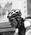
I still had some K's to go myself so I got back on my bike and ascended towards the Signal, the tracks remaining dry and smooth-rolling. Near the end I felt my rear tyre losing air but I made it to the viewpoint overlooking the Fagnes towards neighbouring Germany. There were a lot of tourists around and I was joined by a Forester who was also a keen mountainbiker, so we had something to talk about while he watched me change my inner tyre. He uses kevlar patches to protect his inner tyres but I'm thinking that I will go towards NoTubes. I already have specced NoTubes on my newest bike - the yet-to-be-built Merlin Works 4.0. I complained to the Forester about the lack of waste bins along the routes in the Fagnes but he countered that the wildlife destroys them when they smell the food thats been left in them. Good point I reckon.
The descent then. I tried a new track, taking me towards the Croix des Fiances and the Vecquee again. A small track with some very interesting technical challenges. I'm not sure if bikes are allowed though, but I did not see any sign indicating they were not. At one point I had to cross a little stream by foot before having to ride over some plank-bridges that spanned some very wet patches of moor.
 Along the Vecquee then back towards Hockai and the Hoegne. The Hoegne river is the red thread that leads throughout the descent, which obviously is one of the longest to be experienced in Belgium. The bike was getting wet from time to time because the track crossed the Hoegne, either via a concrete ford or just plain through the little river itself. There is no way you can do a ride in the Ardennes without getting your bike wet, even in the midst of Summer. The bike performed well and by now I began to feel the kilometers stacking up. Even during the downhill there are still a few uphills bits, not far but they hurt. When I arrived in Polleur again I went back up the hill for a nice little finale adding another 110 heightmeters to my Polar counter.
Ride Stats : 71K and 1120 heightmeters in 4h19mins

I encountered a group of some twenty teenagers who looked lost and asked me how to get to Hockai. I pointed them into the right direction, adding to their horror that it would take them at least 10k before they would get there. Yeah, I am a mean bastard, but that will teach them walking into the Fagnes without a map. It couldn't have been more than 4 or 5K, so they will be happy in the end.

I still had some K's to go myself so I got back on my bike and ascended towards the Signal, the tracks remaining dry and smooth-rolling. Near the end I felt my rear tyre losing air but I made it to the viewpoint overlooking the Fagnes towards neighbouring Germany. There were a lot of tourists around and I was joined by a Forester who was also a keen mountainbiker, so we had something to talk about while he watched me change my inner tyre. He uses kevlar patches to protect his inner tyres but I'm thinking that I will go towards NoTubes. I already have specced NoTubes on my newest bike - the yet-to-be-built Merlin Works 4.0. I complained to the Forester about the lack of waste bins along the routes in the Fagnes but he countered that the wildlife destroys them when they smell the food thats been left in them. Good point I reckon.
The descent then. I tried a new track, taking me towards the Croix des Fiances and the Vecquee again. A small track with some very interesting technical challenges. I'm not sure if bikes are allowed though, but I did not see any sign indicating they were not. At one point I had to cross a little stream by foot before having to ride over some plank-bridges that spanned some very wet patches of moor.
 Along the Vecquee then back towards Hockai and the Hoegne. The Hoegne river is the red thread that leads throughout the descent, which obviously is one of the longest to be experienced in Belgium. The bike was getting wet from time to time because the track crossed the Hoegne, either via a concrete ford or just plain through the little river itself. There is no way you can do a ride in the Ardennes without getting your bike wet, even in the midst of Summer. The bike performed well and by now I began to feel the kilometers stacking up. Even during the downhill there are still a few uphills bits, not far but they hurt. When I arrived in Polleur again I went back up the hill for a nice little finale adding another 110 heightmeters to my Polar counter.
Ride Stats : 71K and 1120 heightmeters in 4h19mins